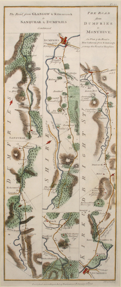
The Road from Glasgow & Kilmarnock to Sanquhar & Dumfries (Continued). The Road from Dumfries to Monyhive.
In 1776, road surveyors George Taylor and Andrew Skinner published strip maps of over 3000 miles of Scottish roads, followed in 1778 by 8000 miles of Irish roads. The maps include land owners and their properties.
The late 1700s saw the production of high quality maps, detailing the most accurate surveys to date of the south west of Scotland. In the first half of the nineteenth Century maps were needed to show the changes to the countryside brought about by agricultural improvements and road building. Map making in Scotland reached a high point, several accurate and detailed surveys of the country were published and county by county maps were made.
Object no :
DMMP002n
Collection :
Creator :
George Taylor & Andrew Skinner
Place of Production :
NA
Dimensions :
L 485mm, W 205mm
Materials :
paper
Location :
NA
Accession number :
DUMFM:2001.23.6.1=2
Copyright :
Dumfries & Galloway Council