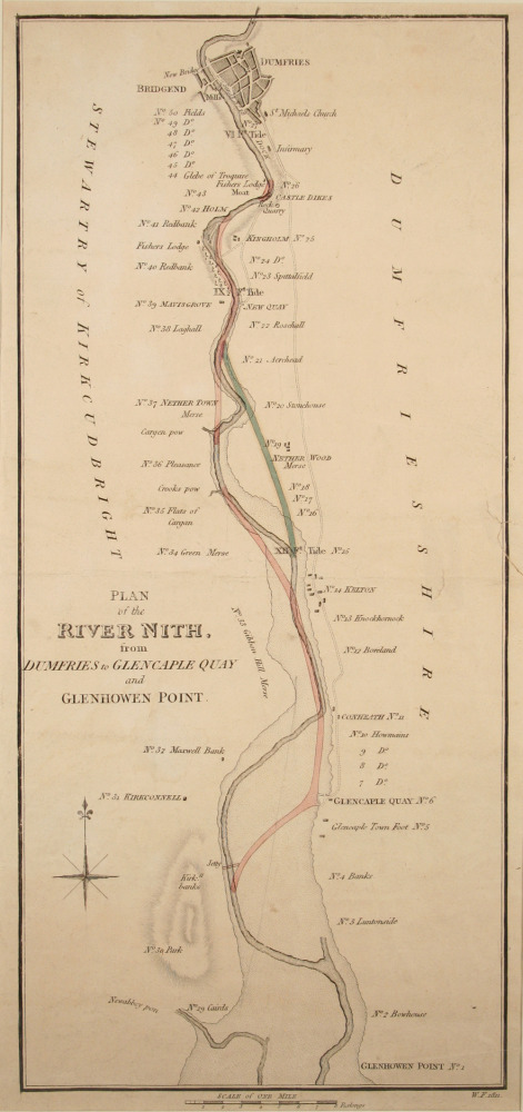
“Plan of the River Nith from Dumfries to Glencaple Quay and Glenhowen Point”, 1811.
By 1810 navigation in the Nith had become almost impossible above Kelton except at the highest tides.
James Hollingsworth, a civil engineer, undertook a survey of the Nith, and drew up a plan for improvements in the course of the river. An Act of Parliament passed in 1811 appointed a Nith Navigation Commission to make the improvements, and the Town Council passed over the running of the port to the commissioners. After the improvements ships could off-load their cargoes at the Whitesands, and Dumfries became a major port.
This plan shows how the River Nith was improved for shipping by the work undertaken by the Nith Navigation Commission.
Object no :
DMMP001n
Collection :
Creator :
James Hollingsworth
Place of Production :
NA
Dimensions :
NA
Materials :
paper
Location :
NA
Accession number :
DUMFM:1965.793
Copyright :
Dumfries & Galloway Council